- Printed on Tyvek® (synthetic)
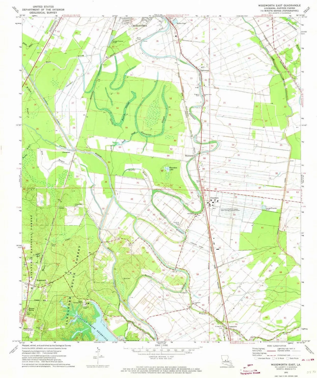
- USGS topographic map of Woodworth East, LA, at 1:24000 scale. Lighter material. Waterproof. Tear-resistant. Foldable. Very durable. Perfect for backpacking and the outdoors.
- Cities, towns, villages: Willow Glen,Inglewood,Chambers,Cooley,Moreland,Woodworth,Lamourie,Cloverdale
- Mountains: High elevation topographical features like high summits and peaks.
- Valleys: Low elevation topographic features such as flatlands, river valleys, and canyons.
USGS topographic map of Woodworth East, Louisiana, dated 1972, updated 1974.
Includes geographic coordinates (latitude and longitude), lines of elevation, bodies of water, roads, and more. This topo quad is suitable for recreational, outdoor uses, office applications, or wall map framing.
Printed on-demand by YellowMaps on the print material of your choice.
Shipping rolled from Minneapolis, MN, United States.
Product Number: USGS-5592458
Map Size: 26.8 inches high x 22.9 inches wide
Map Scale: 1:24000
Map Type: POD USGS Topographic Map
Map Series: HTMC
Map Version: Historical
Cell ID: 49853
Scan ID: 333582
Imprint Year: 1974
Woodland Tint: Yes
Aerial Photo Year: 1971
Field Check Year: 1972
Datum: NAD27
Map Projection: Lambert Conformal Conic
Map published by United States Geological Survey
Map Language: English
Scanner Resolution: 600 dpi
Map Cell Name: Woodworth East
Grid size: 7.5 X 7.5 Minute
Date on map: 1972
Geographical region: Louisiana, United States
Northern map edge Latitude: 31.25°
Southern map edge Latitude: 31.125°
Western map edge Longitude: -92.5°
Eastern map edge Longitude: -92.375°
Surrounding map sheets (copy & paste the Product No. in the search bar):
North: USGS-5588036,USGS-5588032,USGS-5588040,USGS-5588034,USGS-5593452
East: USGS-5590518,USGS-5590516
South: USGS-5590532,USGS-5590534,USGS-5590536
West: USGS-5592470,USGS-5592466,USGS-5592468
![Jon Boat Cover Fit Lowe L1852MT L1872, 18ft Trailerable 900D Heavy Duty with PU Coating 100% Waterproof & UV-Resistant, [Motor Cover Included]](https://www.magcompass.shop/image/jon-boat-cover-fit-lowe-l1852mt-l1872-18ft-trailerable-900d-heavy-duty-with-pu-coating-100-waterproof-amp-uv-resistant-motor-cover-included_sw75sD_300x.webp "Jon Boat Cover Fit Lowe L1852MT L1872, 18ft Trailerable 900D Heavy Duty with PU Coating 100% Waterproof & UV-Resistant, [Motor Cover Included]")


")
(Gold)")


")


