- Printed on Tyvek® (synthetic)
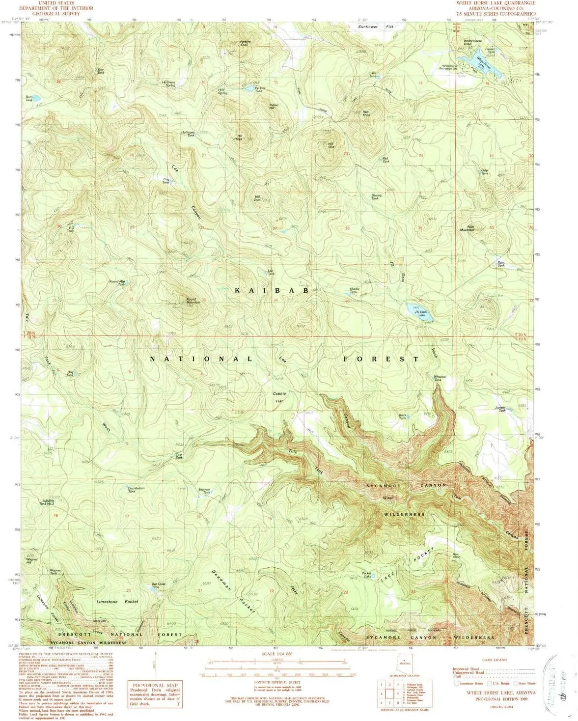
- USGS topographic map of White Horse Lake, AZ, at 1:24000 scale. Lighter material. Waterproof. Tear-resistant. Foldable. Very durable. Perfect for backpacking and the outdoors.
- Cities, towns, villages: Please see map preview to find populated places, townships, as well as roads and street names if available.
- Mountains: Round Mountain,Hill Three,Hill Two,White Horse Knoll,Perkins Knoll,Ruin Mountain,Red Knoll,Wagner Hill,Indian Hill,Hill One
- Valleys: Lee Canyon
USGS topographic map of White Horse Lake, Arizona, dated 1989, updated 1990.
Includes geographic coordinates (latitude and longitude), lines of elevation, bodies of water, roads, and more. This topo quad is suitable for recreational, outdoor uses, office applications, or wall map framing.
Printed on-demand by YellowMaps on the print material of your choice.
Shipping rolled from Minneapolis, MN, United States.
Product Number: USGS-5557220
Map Size: 26.9 inches high x 22 inches wide
Map Scale: 1:24000
Map Type: POD USGS Topographic Map
Map Series: HTMC
Map Version: Historical
Cell ID: 48689
Scan ID: 314053
Imprint Year: 1990
Woodland Tint: Yes
Visual Version Number: 1
Aerial Photo Year: 1986
Edit Year: 1989
Field Check Year: 1987
Datum: NAD27
Map Projection: Transverse Mercator
Provisional map: Yes
Map published by United States Geological Survey
Map Language: English
Scanner Resolution: 600 dpi
Map Cell Name: White Horse Lake
Grid size: 7.5 X 7.5 Minute
Date on map: 1989
Geographical region: Arizona, United States
Northern map edge Latitude: 35.125°
Southern map edge Latitude: 35°
Western map edge Longitude: -112.125°
Eastern map edge Longitude: -112°
Surrounding map sheets (copy & paste the Product No. in the search bar):
North: USGS-5551406
East: USGS-5618326,USGS-5549518,USGS-5549110,USGS-5549350,USGS-5618332
South: USGS-5556400,USGS-5556398
West: USGS-5553710


