- Printed on Tyvek® (synthetic)
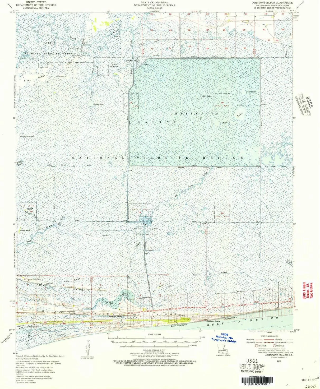
- USGS topographic map of Johnsons Bayou, LA, at 1:62500 scale. Lighter material. Waterproof. Tear-resistant. Foldable. Very durable. Perfect for backpacking and the outdoors.
- Cities, towns, villages: Peveto Beach,Lone Pine,Johnsons Bayou,Constance Beach
- Mountains: High elevation topographical features like high summits and peaks.
- Valleys: Low elevation topographic features such as flatlands, river valleys, and canyons.
USGS topographic map of Johnsons Bayou, Louisiana, dated 1955, updated 1956.
Includes geographic coordinates (latitude and longitude), lines of elevation, bodies of water, roads, and more. This topo quad is suitable for recreational, outdoor uses, office applications, or wall map framing.
Printed on-demand by YellowMaps on the print material of your choice.
Shipping rolled from Minneapolis, MN, United States.
Product Number: USGS-5683447
Map Size: 21.8 inches high x 17.9 inches wide
Map Scale: 1:62500
Map Type: POD USGS Topographic Map
Map Series: HTMC
Map Version: Historical
Cell ID: 55897
Scan ID: 334679
Imprint Year: 1956
Woodland Tint: Yes
Aerial Photo Year: 1951
Edit Year: 1955
Survey Year: 1934
Datum: NAD27
Map Projection: Polyconic
Map published by United States Geological Survey
Keywords: Overedge with No Adjacent Map
Map Language: English
Scanner Resolution: 600 dpi
Map Cell Name: Johnsons Bayou
Grid size: 15 X 15 Minute
Date on map: 1955
Geographical region: Louisiana, United States
Northern map edge Latitude: 30°
Southern map edge Latitude: 29.75°
Western map edge Longitude: -93.75°
Eastern map edge Longitude: -93.5°
Surrounding map sheets (copy & paste the Product No. in the search bar):
North: USGS-5594622,USGS-5479057,USGS-5591312,USGS-5677660,USGS-5593230
East: USGS-5593680,USGS-5589914,USGS-5592888,USGS-5589920,USGS-5593678
South: USGS-5591890
West: USGS-5592350,USGS-5592356,USGS-5592352,USGS-5479127,USGS-5592354
![Raymarine ITC-5 Analog to Digital Transducer Converter - Seatalkng [E70010]](https://www.magcompass.shop/image/raymarine-itc-5-analog-to-digital-transducer-converter-seatalkng-e70010_Qsnd0k_300x.webp "Raymarine ITC-5 Analog to Digital Transducer Converter - Seatalkng [E70010]")


")
")


")

