- Printed on Tyvek® (synthetic)
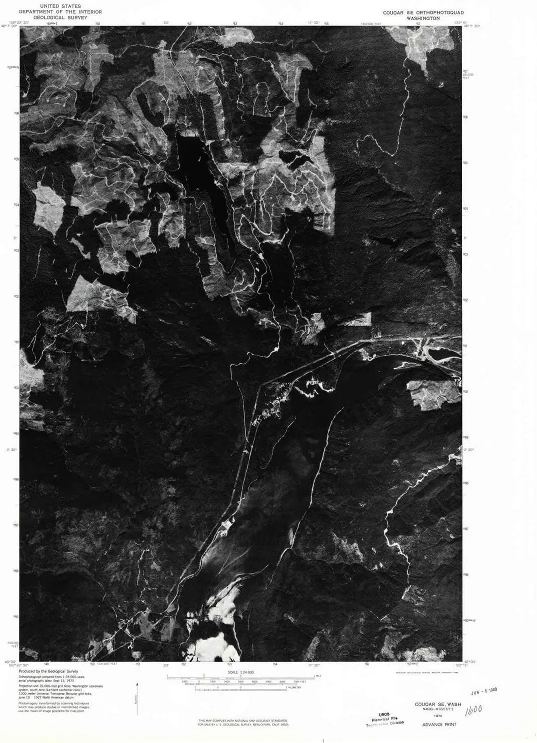
- USGS topographic map of Cougar SE, WA, at 1:24000 scale. Lighter material. Waterproof. Tear-resistant. Foldable. Very durable. Perfect for backpacking and the outdoors.
- Cities, towns, villages: Cougar
- Mountains: Cinnamon Peak
- Valleys: Christmas Canyon,Christmass Canyon
USGS topographic map of Cougar SE, Washington, dated 1975, updated 1980.
Includes geographic coordinates (latitude and longitude), lines of elevation, bodies of water, roads, and more. This topo quad is suitable for recreational, outdoor uses, office applications, or wall map framing.
Printed on-demand by YellowMaps on the print material of your choice.
Shipping rolled from Minneapolis, MN, United States.
Product Number: USGS-5932313
Map Size: 26.9 inches high x 22.1 inches wide
Map Scale: 1:24000
Map Type: POD USGS Topographic Map
Map Series: HTMC
Map Version: Historical
Cell ID: 10331
Scan ID: 240698
Imprint Year: 1980
Aerial Photo Year: 1975
Datum: NAD27
Map Projection: Lambert Conformal Conic
Advance: Yes
Orthophoto: Quad
Map published by United States Geological Survey
Map Language: English
Scanner Resolution: 600 dpi
Map Cell Name: Cougar
Grid size: 7.5 X 7.5 Minute
Date on map: 1975
Geographical region: Washington, United States
Northern map edge Latitude: 46.125°
Southern map edge Latitude: 46°
Western map edge Longitude: -122.375°
Eastern map edge Longitude: -122.25°
Surrounding map sheets (copy & paste the Product No. in the search bar):
North: USGS-5404480,USGS-5403572,USGS-5404478
East: USGS-5410324,USGS-5410322,USGS-5406730,USGS-5410326,USGS-5406728
South: USGS-5409418,USGS-5409420,USGS-5409422
West: USGS-5405288,USGS-5405286

 Black Multi 4 Big Kid M")


, for Wedding, Birthdays, Home, Office, and Garden Decorations")

![Ritchie XP-99 Kayaker Compass - Surface Mount - Black [XP-99]](https://www.magcompass.shop/image/ritchie-xp-99-kayaker-compass-surface-mount-black-xp-99_0NXOZy_300x.webp "Ritchie XP-99 Kayaker Compass - Surface Mount - Black [XP-99]")

