- Printed on Tyvek® (synthetic)
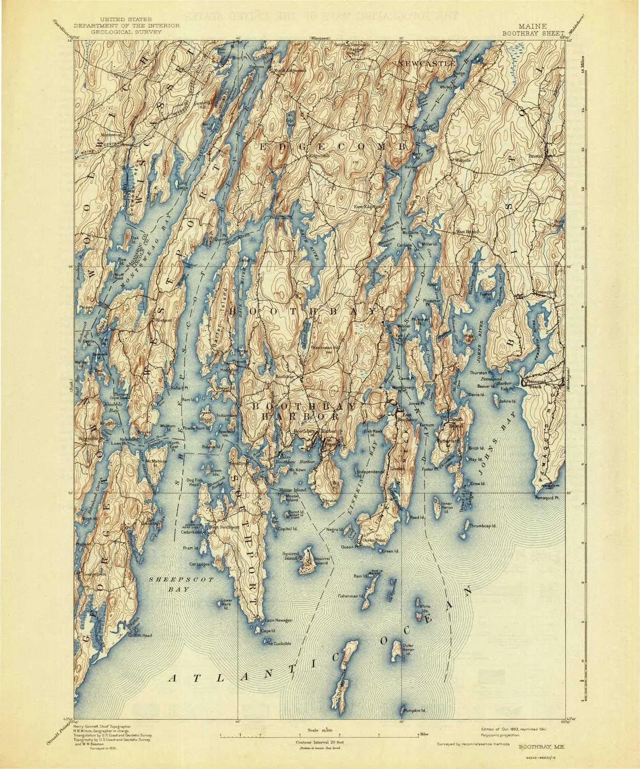
- USGS topographic map of Boothbay, ME, at 1:62500 scale. Lighter material. Waterproof. Tear-resistant. Foldable. Very durable. Perfect for backpacking and the outdoors.
- Cities, towns, villages: Robinhood,Murphys Corner,Boothbay,Back Narrows,Ocean Point,Edgecomb,Spruce Shores,Five Islands,Oak Hill,South Bristol,Hendricks Harbor,Walpole,East Edgecomb,Montsweag,Pemaquid (historical),MacMahan,West Bristol,Mouse Island,North Edgecomb,Boothbay Harbor,Westport,West Southport,Pools Landing,Mount Pisgah,Spruceworld,West Boothbay Harbor,Christmas Cove,Dover,Pemaquid Beach,Southport,Trevett,Newagen,Linekin,Bristol,Pemaquid Harbor,Heron Island,Georgetown
- Mountains: Burleigh Hill,Beech Hill,Ozone Mountain,Mount Hunger,Doggett Castle,Tyler Hill,Cushman Hill,Haggett Hill,Knubble,High Head,Lookout Hill,Smith Hill,McCobb Hill,Kenniston Hill
- Valleys: Low elevation topographic features such as flatlands, river valleys, and canyons.
USGS topographic map of Boothbay, Maine, dated 1893, updated 1941.
Includes geographic coordinates (latitude and longitude), lines of elevation, bodies of water, roads, and more. This topo quad is suitable for recreational, outdoor uses, office applications, or wall map framing.
Printed on-demand by YellowMaps on the print material of your choice.
Shipping rolled from Minneapolis, MN, United States.
Product Number: USGS-5683865
Map Size: 19.8 inches high x 16.5 inches wide
Map Scale: 1:62500
Map Type: POD USGS Topographic Map
Map Series: HTMC
Map Version: Historical
Cell ID: 51646
Scan ID: 460221
Imprint Year: 1941
Survey Year: 1891
Datum: Unstated
Map Projection: Polyconic
Map published by United States Geological Survey
Map Language: English
Scanner Resolution: 600 dpi
Map Cell Name: Boothbay
Grid size: 15 X 15 Minute
Date on map: 1893
Geographical region: Maine, United States
Northern map edge Latitude: 44°
Southern map edge Latitude: 43.75°
Western map edge Longitude: -69.75°
Eastern map edge Longitude: -69.5°
Surrounding map sheets (copy & paste the Product No. in the search bar):
North: USGS-5537301,USGS-5685469,USGS-5537291,USGS-5537293,USGS-5685473
East: USGS-5536757,USGS-5536755,USGS-5684649,USGS-5534645,USGS-5684647
South:
West: USGS-5536067,USGS-5536075,USGS-5536063,USGS-5683743,USGS-5683755


![Pack of 4 Portable Lawn Chairs, with Built-in Can Cooler, Storage Pocket, Carry Bag, and Cup Holder, Includes Carry Bag – Black [4-Pack]](https://www.magcompass.shop/image/pack-of-4-portable-lawn-chairs-with-built-in-can-cooler-storage-pocket-carry-bag-and-cup-holder-includes-carry-bag-black-4-pack_TgmDET_300x.webp "Pack of 4 Portable Lawn Chairs, with Built-in Can Cooler, Storage Pocket, Carry Bag, and Cup Holder, Includes Carry Bag – Black [4-Pack]")


")
